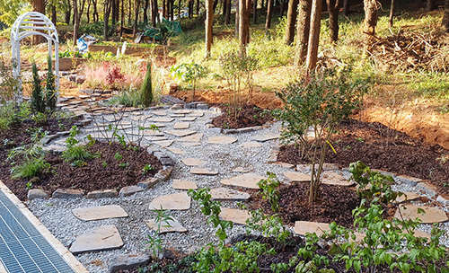
| ▲ 석축 저수조 전경. / 사진제공 = 익산시청 © 김현종 기자 |
|
| ▲ 백제왕도 핵심 유적인 전북 익산 미륵산성 발굴 결과, 정상부 아래 평탄지에서 백제시대로 추정되는 토루와 수 차례 개축된 석축 저수조가 확인돼 추가 조사가 필요할 것으로 판단되고 있다. / 사진제공 = 익산시청 © 김현종 기자 |
|
| ▲ 축조기술력을 알 수 있는 토루(土壘 = 흙으로 쌓아 둔덕지게 만든 방어용 둔턱) 성토양상. / 사진제공 = 익산시청 © 김현종 기자 |
|
백제왕도 핵심 유적인 전북 익산 미륵산성 발굴 결과, 정상부 아래 평탄지에서 백제시대로 추정되는 토루와 수차례 개축된 석축 저수조가 확인됐다.
익산 미륵산성은 미륵사지의 배후에 있는 미륵산(해발 430.2m) 정상부와 동쪽 사면을 감싼 포곡식(包谷式 = 산 정상부에서 계곡을 포함하고 내려온 능선부에 성벽을 축조)산성(山城)으로 북쪽으로 낭산산성과 남동쪽의 선인봉산성과 당치산성ㆍ동쪽으로 용화산성과 학현산성ㆍ천호산성으로 연결돼 논산ㆍ부여ㆍ완주ㆍ전주ㆍ김제 일원의 조망이 가능한 요충지라 할 수 있다.
익산시와 (재)전북문화재연구원은 문화재청의 허가를 받아 지난 3월부터 6월까지 백제왕도 핵심 유적인 익산 미륵산성 유적 정비를 위해 성내 평탄지를 발굴조사 했다.
미륵산성에 대한 발굴조사는 1990년을 시작으로 총 3차례에 걸쳐 이뤄졌다.
발굴조사를 통해 미륵산성의 문지(동문지ㆍ남문지)와 옹성((甕城 = 성문 앞에 축조된 항아리 모양의 시설물로 적이 직접 성문에 접근하는 것을 차단할 목적으로 설치한 것)ㆍ치성(雉城 = 성벽 일부를 돌출시켜 적의 접근을 조기에 관찰하고 성벽에 접근한 적을 정면이나 측면에서 공격할 수 있는 시설물)을 포함한 건물지와 집수정 등이 조사됐다.
시기는 통일신라시대 이후로 판단하고 있다.
다만, 조사과정에 백제시대 토기편이 다수 출토됐으나 이와 관련된 유구는 확인되지 않았다.
이번 발굴조사 지역은 삼국(백제)시대와 관련된 유적을 확인하기 위해 미륵산성 정상부(장군봉) 아래 평탄지를 대상으로 이뤄졌으며 기존 지표조사에서 백제시대 지명인 '금마저성(金馬渚城)' 명문기와가 수습된 장소다.
조사에서 확인된 토루(土壘 = 흙으로 쌓아 둔덕지게 만든 방어용 둔턱)는 반원형으로 확인된 둘레는 77.3m 정도며 너비는 9.8mㆍ잔존높이는 3.1m다.
성토(盛土)방법은 성질이 다른 흙을 사용해 교차로 쌓고 중간에 토류석(土留石 = 지하 구조물을 만들 때 측면이 무너지지 않도록 지지하는 돌)을 시설했으며 필요에 따라 방향을 달리해 경사성토를 한 모습과 성토층에서 목탄(숯)ㆍ목주(나무기둥)가 확인되는 것으로 보아 당시 토루를 견고히 하기 위한 축조기술력을 알 수 있는 중요한 자료로 평가된다.
석축 저수조는 현재까지 최소 4차례에 걸쳐 수개축이 이뤄진 이후 최종적으로 원형의 석축우물이 축조된 것으로 판단된다.
1차는 원형으로 추정됐으며 직경 750㎝ 정도 규모로 높이는 58㎝ㆍ4단 정도가 잔존하고 있다.
2차는 말각방형으로 남북 길이는 350㎝ㆍ높이 63㎝로 4단 정도 남아있다.
3차는 남북 방향으로 긴 장방형으로 남북길이 780㎝ㆍ동서길이 645㎝ 규모로 높이 146㎝ㆍ7단 정도의 석축이 잔존하고 있다.
4차는 방형으로 동서너비 560㎝로 1단만 남아있다.
석축 저수조의 내부에서는 삼국시대 토기편과 통일신라시대 이후의 대호편ㆍ선문계ㆍ격자문계 평기와편 등이 확인됐다.
특히 이번 조사에서 확인된 토루(土壘)는 기존 조사(2003년 전북고대산성조사보고서)에 따르면 삼국시대 테뫼식(산 정상부를 둘러서 쌓은 산성)산성으로 추정되는 지역으로 추후 지형분석과 지속적인 학술조사를 통해 그 실체를 밝혀야 할 것으로 분석됐다.
또한 석축 저수조의 정확한 축조시기와 성격 및 토루와의 상관관계를 명확하게 밝히기 위해 추가 조사가 필요할 것으로 판단되고 있다.
한편, 익산시는 문화재청과 이번 발굴조사 성과를 바탕으로 미륵산성의 진정성 있는 정비와 관리 방안을 수립하고 체계적인 조사를 지속적으로 지원해 역사적 정체성 확보 및 유적의 보존과 관리를 높인다는 방침이다.
☞ 아래는 위 기사를 구글 번역이 번역한 영문 기사의 '전문' 입니다.
구글 번역은 이해도를 높이기 위해 노력하고 있으며 영문 번역에 오류가 있음을 전제로 합니다.
【Below is the 'full text' of the English article translated by Google Translate.
Google Translate is working hard to improve understanding, and assumes that there are errors in the English translation.】
Iksan Mireuksanseong Fortress… The 'level ground' below the summit
Confirmation of mounds and stone reservoirs presumed to be from the Baekje era
Reporter Kim Hyun-jong
As a result of the excavation of Mireuksanseong Fortress in Iksan, Jeollabuk-do, a key relic of the Baekje Dynasty, a mound presumed to be from the Baekje era and a stone-built water tank renovated several times were confirmed in the flat area below the summit.
Iksan Mireuksanseong Fortress is located in the back of Mireuksa Temple Site, and is located in a paved style(a wall is built on the ridge that descends from the top of the mountain) covering the top and eastern slope of Mireuksan Mountain(430.2m above sea level). It is connected to Seoninbongsanseong Fortress and Dangchisanseong Fortress to the southeast, Yonghwasanseong Fortress, Hakhyeonsanseong Fortress, and Cheonhosanseong Fortress to the east, making it a key point from which you can see Nonsan, Buyeo, Wanju, Jeonju, and Gimje.
Iksan City and the Jeonbuk Cultural Heritage Research Institute received permission from the Cultural Heritage Administration to excavate and survey flat land within the fortress from March to June to maintain the remains of Mireuksanseong Fortress in Iksan, a key site of the Baekje Dynasty.
The excavation of Mireuksanseong Fortress was conducted three times starting in 1990.
Through excavation research, the gates of Mireuksanseong(East Gate and South Gate), Ongseong(甕城 = a jar-shaped facility built in front of the fortress gate and installed for the purpose of blocking enemy direct access to the fortress gate), and Chiseong(雉城 = part of the fortress wall) were discovered. Building sites and catchment wells were investigated, including a facility that protruded to observe the approach of the enemy at an early stage and attacked enemies approaching the wall from the front or from the side.
The period is judged to be after the Unified Silla period.
However, during the investigation, many pieces of earthenware from the Baekje period were excavated, but no related artifacts were identified.
This excavation survey area was conducted on the flat land under the top of Mireuksanseong(Janggunbong) to identify the remains related to the Three Kingdoms(Baekje) period. It is a place that has been repaired.
The mound(mound for defense made by stacking earth) confirmed in the investigation was semicircular, with a circumference of about 77.3m, a width of 9.8m, and a remaining height of 3.1m.
As for the embankment method, soils of different properties are used to pile up crosswise, and earth stones(a stone that supports the side of the underground structure to prevent it from collapsing) are installed in the middle. Considering that charcoal(charcoal) and wooden poles(wood poles) were identified in the embankment layer and the embankment layer, it is evaluated as an important data to know the construction technology to strengthen the mound at the time.
It is judged that the circular stone well was finally built after several repairs have been carried out at least four times for the stone reservoir.
The first one was presumed to be circular, with a diameter of about 750 cm and a height of 58 cm and 4 tiers remaining.
The second is a horse-shaped square with a north-south length of 350 cm and a height of 63 cm, with about 4 tiers remaining.
The 3rd is a long rectangle in the north-south direction, with a north-south length of 780 cm and an east-west length of 645 cm.
The 4th car is a square with an east-west width of 560 cm, and only one tier remains.
Inside the stone-built cistern, pottery pieces from the Three Kingdoms Period and Daeho-pyeon, Seonmun-gye, and Gridjamun-gye Pyeongwa-pyeon from the Unified Silla Period were found.
In particular, the Tulou identified in this survey is an area presumed to be a Temo-type(mountain built around the top of a mountain) during the Three Kingdoms Period, according to the previous survey(2003 Jeonbuk Ancient Mountain Fortress Survey Report), and further topographical analysis and ongoing academic research It was analyzed that the reality should be revealed through
In addition, it is judged that additional investigations are needed to clarify the exact time and nature of the stone-built water tank and its correlation with the mound.
Meanwhile, Iksan City plans to establish a sincere maintenance and management plan for Mireuksanseong Fortress based on the results of this excavation with the Cultural Heritage Administration, and to continuously support systematic investigations to secure its historical identity and enhance the preservation and management of the ruins.


 많이 본 뉴스


