 |
 |
|
 |
 |
 м»Өл®ӨлӢҲнӢ° н”јн”Ң лҸ…мһҗнҲ¬кі м»Өл®ӨлӢҲнӢ° н”јн”Ң лҸ…мһҗнҲ¬кі
|
 |
 | |
|
|


|
|
мғҲл§ҢкёҲ мӮ¬м—…мқҖ 40,900ha(1м–ө2мІңл§ҢнҸү)мқҳ мғҲлЎңмҡҙ мңЎм§Җк°Җ нҳ•м„ұлҗҳлҠ” көӯк°ҖмӮ¬м—…мқҙлӢӨ.
кі кө°мӮ°лҸ„лҘј нҸ¬н•Ён•ң мғҲл§ҢкёҲ л•…мқҙ л§ҺмқҖ м—ӯмӮ¬л¬ён—Ңм—җ нҶөмқјмӢ лқјгҶҚкі л ӨгҶҚмЎ°м„ мӢңлҢҖ 1896л…„ к°‘мҳӨкІҪмһҘ л•Ңк№Ңм§Җ 1200л…„ мқҙмғҒ к№Җм ңгҶҚл§ҢкІҪ кҙҖн• мқҙм—ҲлӢӨ.
к°‘мҳӨкІҪмһҘ л•Ң кі мў…мқҳ м№ҷл №мңјлЎң м„ңн•ҙм•Ҳ лҸ„м„ңлҘј мқјм ңк°•м җкё°мқё 1914л…„к№Ңм§Җ 18л…„к°„ м „лӮЁм§ҖлҸ„кө°м—җ нҺёмһ…лҗҗлӢӨк°Җ н•ҙмІҙмӢң к№Җм ңлЎң ліөмӣҗмқҙ лӢ№м—°н•ҳлӮҳ мқ„мӮ¬мҳӨм Ғ(д№ҷе·ідә”иіҠ) мқҙмҷ„мҡ©мқҳ м••л ҘмңјлЎң мҳҘкө¬кө°м—җ к·ҖмҶҚлҗң кІғмқҙ мҳӨлҠҳм—җ мқҙлҘҙкі мһҲлӢӨ.
м„ӨмғҒк°ҖмғҒмңјлЎң 1914л…„ 3мӣ” 1мқј мЎ°м„ мҙқлҸ…л¶Җл № 111нҳём—җ мқҳкұ°, нҳ„ мғҲл§ҢкёҲм§Җм—ӯм—җ н•ҙмғҒкІҪкі„м„ мқ„ м„Өм •н•ҙ к№Җм ңлҠ” кё°мЎҙмқҳ 37Km н•ҙм•Ҳм„ л§Ҳм Җ м—Ҷм–ҙм ё л°”лӢ·кёёмқҙ л§үнһҳмңјлЎңмҚЁ 1,500м„ёлҢҖ 3,329лӘ… м–ҙлҜјмқҳ мғқкі„к°Җ м–ҙл өкІҢ лҗҗлӢӨ.
мң„мҷҖ к°ҷмқҙ лӮҙлҘҷм§Җм—ӯмңјлЎң м „лқҪн•Ёмқ„ л©ҙн•ҙліҙкі мһҗ мғҲлЎңмҡҙ л•… мғҲл§ҢкёҲм§Җм—ӯмқҳ н•©лҰ¬м Ғмқҙкі н•©лІ•м Ғмқё кІҪкі„ кІ°м •мңјлЎң нҳ‘мҶҢн•ң л°”лӢ·кёёмқҙлқјлҸ„ м—ҙкІ лӢӨлҠ” м—јмӣҗмңјлЎң м§ҖлӮң 2010л…„ 12мӣ” 1мқј л¶Җм•Ҳкө°кіј н•Ёк»ҳ лҢҖлІ•мӣҗм—җ м ңмҶҢн•ң кІ°кіј, м—°м ‘к°ңл…җм—җ л”°лқј 33.9Kmмқҳ л°©мЎ°м ңлҘј л¶Җм•Ҳкө° 4.7Km(1нҳё л°©мЎ°м ң)гҶҚк№Җм ңмӢң 9.9Km(2нҳё л°©мЎ°м ң)гҶҚкө°мӮ°мӢң 19.3Km(3гҶҚ4гҶҚ5нҳё л°©мЎ°м ң)мқҳ кҙҖн• к¶Ңмқ„ нҢҗкІ°н–ҲлӢӨ.
лҳҗ, 2015л…„ 10мӣ” 26мқј н–үм•Ҳл¶Җ мӮ°н•ҳ мӨ‘м•ҷ분мҹҒ мЎ°м •мң„мӣҗнҡҢлҸ„ лҸҷмқјн•ң кІ°м •мқ„ лӮҙл ёлӢӨ.
мқҙм—җ л¶Ҳліөн•ң кө°мӮ°мӢңгҶҚл¶Җм•Ҳкө°мқҖ 2015л…„ 10мӣ” 27мқј лҢҖлІ•мӣҗм—җ м ңмҶҢн–Ҳкі , кө°мӮ°мӢңлҠ” 2016л…„ 1мӣ” 11мқј н—ҢлІ•мһ¬нҢҗмҶҢм—җ м ңмҶҢн•ң кІ°кіј, н—ҢлІ•мһ¬нҢҗмҶҢлҠ” 2020л©ҙ 9мӣ” 24мқј к°Ғн•ҳ нҢҗкІ°н–Ҳкі лҢҖлІ•мӣҗ м—ӯмӢң 2021л…„ 1мӣ” 14мқј кё°к°Ғ нҢҗкІ°н–ҲлӢӨ.
мқҙм—җ л”°лқј, кө°мӮ°мӢңгҶҚк№Җм ңмӢңгҶҚл¶Җм•Ҳкө°мқҳ н–үм •кІҪкі„лҘј л§ҢкІҪк°•кіј лҸҷ진강мқҳ н•ҳмІң мөңмӢ¬м„ мқҙлқјлҠ” кё°мЎҙмқҳ мӮ¬мӢӨм—җ 추к°Җн•ҙ лҢҖлІ•мӣҗ нҢҗкІ°лЎң мғҲл§ҢкёҲм§Җм—ӯмқҳ кІҪкі„м„ к№Ңм§Җ лӘ…нҷ•н•ҳкІҢ кІ°м •лҗҗлӢӨ.
мқҙм ңлҠ” л‘җ лІҲмқҳ лҢҖлІ•мӣҗ нҢҗкІ°кіј н—Ңмһ¬ нҢҗкІ°мқ„ мҲҳмҡ©н•ҳкі лҸ„лҜј лӘЁл‘җк°Җ м§ҖнҳңмҷҖ лҠҘл Ҙмқ„ мҙқ결집н•ҙ мғҲл§ҢкёҲк°ңл°ңм—җ л°•м°ЁлҘј к°Җн•ҙм•ј н•ңлӢӨ.
мғҲл§ҢкёҲмӮ¬м—…мқҖ м—ӯлҢҖ м •к¶Ңм—җм„ң м°¬л°ҘмӢ м„ёлҘј л©ҙм№ҳ лӘ»н•ҙ л§Ң 30л…„ лҸҷм•Ҳ л§ӨлҰҪкіөмӮ¬мқҳ мӢңмһ‘м—җ л¶Ҳкіјн•ң м§Җм§Җл¶Җ진мңјлЎң лҸ„лҜј лӘЁл‘җк°Җ мҡёл¶„мңјлЎң к°Җл“қ м°Ё мһҲлӢӨ.
к·ёлҹ°лҚ°, кө°мӮ°мӢңлҠ” мғҒмӢқм—җ м–ҙкёӢлӮҳлҠ” л¬ём ңлҘј м•јкё° мӢңнӮӨкі мһҲлӢӨ.
м§ҖлӮңн•ҙ 11мӣ” 25мқј к№Җм ң л•… мӢ¬нҸ¬м—җм„ң 2нҳё л°©мЎ°м ңк№Ңм§Җ 20.3KmмқҙлҘҙлҠ” 'лҸҷм„ңлҸ„лЎң'к°Җ к°ңнҶөлҸј лӢ№м—°н•ң н–үм •кө¬м—ӯ кІ°м •мқ„ н•ҳл ӨлҠ”лҚ°, мғҲл§ҢкёҲк°ңл°ңмІӯмқҖ к№Җм ңмӢңк°Җ мҡ”мІӯн•ң 'м§Җм ҒмёЎлҹүм„ұкіјлҸ„'лҘј ліҙлӮҙм§Җ м•Ҡм•ҳлӢӨ.
м „л¶ҒлҸ„лҠ” 'мғҲл§ҢкёҲк¶Ңм—ӯ нҳ‘мқҳнҡҢ'л°ңмЎұмқҙ л¬ҙмғүн•ҳкІҢ мҲҳмҲҳл°©кҙҖмңјлЎң мқјкҙҖн•ҙ 진лӮң 8мӣ” 20мқј кө°мӮ°мӢңк°Җ лҸҷм„ңлҸ„лЎң н–үм •кө¬м—ӯ кҙҖн• кІ°м •мқ„ к№Җм ңмӢңмІҳлҹј н–үм•Ҳл¶Җм—җ мӢ мІӯн•ҳлҠ” м–өм§ҖлҘј л¶Җл ёлӢӨ.
мқҙлҠ” лҢҖн•ңлҜјкөӯмқҳ лӘЁл“ лІ•м§Ҳм„ңмҷҖ мқҙмӣғмӮ¬мҙҢмқҳ кҙҖмҠөгҶҚмғҒмӢқл§Ҳм Җ л¬ҙмӢңн•ҳлҠ” м–ҙл¶Ҳм„ұм„ӨмқҙлӢӨ.
лҚ”мҡұмқҙ мқјм ңк°•м җкё°м—җ мЎ°м„ мҙқлҸ…л¶Җк°Җ м„Өм •н•ң н•ҙмғҒкІҪкі„м„ мңјлЎң, кі кө°мӮ°кө°лҸ„ кҙҖн• л“ұ м—„мІӯлӮҳкІҢ нҠ№нҳңлҘј л°ӣмқҖ кө°мӮ°мӢңк°Җ, к№Җм ң л•…мқҙ 분лӘ…н•ң 'лҸҷм„ңлҸ„лЎң'к№Ңм§Җ м°Ём§Җн•ҳл ӨлҠ” кІғмқҖ л§Ҳм№ҳ 'мҡ°лҰ¬ л•… лҸ…лҸ„'лҘј м°Ём§Җн•ҳл ӨлҠ” мқјліёмқҳ л§Ңн–үкіј лҳ‘к°ҷмқҖ кІғмқҙлӢӨ.
л¬ҙм—ҮліҙлӢӨ м§ҖмІҙ м—Ҷмқҙ л§Ө진н•ҙ мғҲл§ҢкёҲмӮ¬м—… мҷ„кіөмқ„ м•һлӢ№кІЁм•ј н•ңлӢӨ.
мқҙмң лҠ”, лӢЁкө° мқҙлһҳ мөңлҢҖ көӯнҶ нҷ•мһҘ мӮ¬м—…мқё мғҲл§ҢкёҲмӮ¬м—…м—җ лҢҖн•ң мҳЁ көӯлҜјгҶҚнҠ№нһҲ м „л¶ҒлҸ„лҜјмқҳ кё°лҢҖк°Җ л§үмӨ‘н•ҳкё° л•Ңл¬ёмқҙлӢӨ.
мқҙм ңлҠ” мғҲл§ҢкёҲ м§Җм—ӯмқҳ лҜёлһҳм§Җн–Ҙм Ғмқё л№„м „мқ„ м„ёмӣҢ мЎ°кё°мҷ„кіөгҶҚнҶөн•©н–үм •кө¬м—ӯ л…јмқҳгҶҚлҸҷлӮЁм•„к¶Ң н—ҲлёҢ кұҙм„Ө л“ұм—җ лӘЁл“ м—ӯлҹүкіј м§ҖнҳңлҘј 집мӨ‘н•ҙм•ј н•ңлӢӨ.
вҳһ м•„лһҳлҠ” мң„ м№јлҹјмқ„ кө¬кёҖ лІҲм—ӯмңјлЎң лІҲм—ӯн•ң мҳҒл¬ёмқҳ 'м „л¬ё'мқҙлӢӨ. гҖҗBelow is the 'full text' in English translated by Google Translate in the column above.гҖ‘
гҖҗColumnгҖ‘Why is Gunsan so greedy for the land of Gimje? Former Mayor of Gimje, Jeollabuk-do, Jeonbuk
The Saemangeum project is a national project in which 40,900 ha (120 million pyeong) of new land is formed.
According to many historical documents, the land of Saemangeum, including Gogunsando, was under the jurisdiction of Gimje and Mangyeong for more than 1,200 years until 1896, during the Unified Silla, Goryeo, and Joseon dynasties.
At the time of Gapogyeongjang, the West Coast Islands were incorporated into Jeonnamjido-gun for 18 years until 1914, during the Japanese colonial period, by the decree of King Gojong. that is leading up to today.
To make matters worse, according to Ordinance 111 of the Japanese Government-General of Korea on March 1, 1914, a maritime boundary was set in the present Saemangeum area.
As a result of filing a complaint with the Supreme Court with Buan-gun on December 1, 2010 with the desire to open even a narrow sea road as a rational and legal boundary decision for the new land, Saemangeum, in order to avoid becoming an inland area as described above, the result of a complaint with the Supreme Court of The jurisdiction of the seawall of Km was 4.7Km in Buan-gun(Breakwater No. 1), 9.9Km in Gimje City(Breakwater No. 2), and 19.3Km in Gunsan City(Breakwater No. 3, 4, and 5).
Also, on October 26, 2015, the Central Dispute Mediation Committee under the Ministry of Public Administration and Security made the same decision.
Gunsan-si and Buan-gun, dissatisfied with this, filed a complaint with the Supreme Court on October 27, 2015, and the city of Gunsan filed a complaint with the Constitutional Court on January 11, 2016. It was dismissed on the 14th of May.
Accordingly, the administrative boundaries of Gunsan-si, Gimje-si, and Buan-gun were added to the existing fact that they were the deepest lines of the Mangyeong and Dongjin Rivers, and the Supreme Court ruling clearly determined the boundaries of the Saemangeum area.
Now, it is necessary to accept the two Supreme Court rulings and the Constitutional Court rulings, and to spur the development of Saemangeum by gathering all the wisdom and ability of all residents.
The Saemangeum project has been in a state of disrepair under successive governments, and all residents are filled with resentment due to the sluggish support that has been just the beginning of the reclamation project for 30 years.
However, Gunsan City is causing problems that go against common sense.
On November 25, last year, the 'East-West Road', which stretched 20.3 km from Simpo in Gimje to Seawall No. 2, was opened to determine the administrative district, but the Saemangeum Development Administration did not send the 'cadastral survey results' requested by the city of Gimje.
Jeollabuk-do was consistent with the inauguration of the 'Saemangeum Regional Council', and on August 20, Jinnan, Gunsan-si applied to the Ministry of Public Administration and Security to decide the administrative district of Dongseo-do just like Gimje-si.
This is an absurd statement that ignores all the laws and order of the Republic of Korea and even the customs and common sense of its neighbors.
Moreover, as a maritime boundary line set by the Japanese Government-General of Korea during the Japanese colonial period, Gunsan City, which received tremendous privileges such as jurisdiction over Gogunsan Islands, and even the 'East-West Road' with clear Gimje land, is like Japan's atrocities to occupy 'our land, Dokdo'. will be.
Above all, we need to advance the completion of the Saemangeum project by pushing forward without delay.
The reason is that the expectations of the entire nation, especially Jeollabuk-do, for the Saemangeum Project, the largest land expansion project since Dangun, are high.
Now, we need to establish a future-oriented vision for the Saemangeum region and focus all our capabilities and wisdom on early completion, discussion of integrated administrative districts, and construction of a hub for Southeast Asia. |
|||||
|
|||||


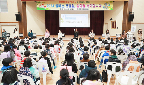
- гҖҗкё°кі гҖ‘к№Җм ң мӢңлҜј лӘЁмҡ• 'лӢЁмІҙн–үлҸҷ л¶ҲмӮ¬' кІҪкі !
- к№Җм ңмӢң, 928м–өмӣҗвҶ‘ 'м ң1нҡҢ 추кІҪ' нҺём„ұ
- к№Җм ңмӢң 'м ң51нҡҢ м–ҙлІ„мқҙлӮ ' кё°л…җмӢқ к°ңмөң
- м ң16нҡҢ к№Җм ңлӘЁм•…мӮ°м¶•м ң 'нҸҗл§ү'
- к№Җм ңмӢң 'нҠ№мқҙлҜјмӣҗ лҢҖмІҳ, лӘЁмқҳнӣҲл Ё' мӢӨмӢң
- к№Җм ң 'м§ҖнҸүм„ кҙ‘нҷң н–Үк°җмһҗ축м ң' м„ұлЈҢ
- к№Җм ң мӢңлҜјлӢЁмІҙ 'мғҲл§ҢкёҲ нҶө추мң„' 맹비лӮң
- 'м ң16нҡҢ к№Җм ңлӘЁм•…мӮ°м¶•м ң' 28мқј к°ңл§ү
- к№Җм ңмӢң 'м ң51нҡҢ ліҙкұҙмқҳ лӮ ' кё°л…җмӢқ к°ңмөң
- к№Җм ң м„ңнқҘ лҶҚкіөлӢЁм§ҖвҖҰ лҶҚмӢқн’Ҳл¶Җ кіөлӘЁ м„ м •
- м •м„ұмЈј к№Җм ңмӢңмһҘ 'лҢҖмҠ№к·ёлЈ№' л°©л¬ё
- гҖҗкё°нҡҚгҖ‘к№Җм ңмӢң 'м§ҖмҶҚк°ҖлҠҘн•ң м„ұмһҘ лҸҷл Ҙ' нҷ•ліҙ
- мЎ°лі‘л‘җ м ңм „к№Җм ңн–Ҙнӣ„нҡҢмһҘ '500л§Ңмӣҗ' кё°нғҒ
- к№Җм ңмӢң 'мҶҢмғҒкіөмқё мӢңм„ӨгҶҚкІҪмҳҒк°ңм„ ' м§Җмӣҗ
- 'м ң60нҡҢ м „л¶ҒлҸ„лҜјмІҙм „' мқјм •, мөңмў… нҷ•м •
- гҖҗкё°нҡҚгҖ‘2023л…„ мғҲн•ҙ, к№Җм ңмӢң мӢңм •м„Өкі„ – н•ҳ
- гҖҗкё°нҡҚгҖ‘2023л…„ мғҲн•ҙ, к№Җм ңмӢң мӢңм •м„Өкі„ - мғҒ
- гҖҗмқёмӮ¬гҖ‘к№Җм ңмӢң – 2023л…„ мғҒл°ҳкё° мҠ№м§„ лӮҙм •
- к№Җм ңмӢңвҖҰ 16мқјл¶Җн„° 'мӢңнӢ° нҲ¬м–ҙлІ„мҠӨ' мҡҙмҳҒ
- гҖҗмӢ л…„мӮ¬гҖ‘м •м„ұмЈј к№Җм ңмӢңмһҘ
 л§Һмқҙ ліё лүҙмҠӨ


к°ңмқём •ліҙм·Ёкёүл°©м№Ё г…Ј нҡҢмӮ¬мҶҢк°ң г…Ј л§Ңл“ңлҠ” мӮ¬лһҢл“Ө г…Ј мңӨлҰ¬к°•л № г…Ј мІӯмҶҢл…„ліҙнҳём •мұ… г…Ј кё°мӮ¬м ңліҙ г…Ј ліҙлҸ„мһҗлЈҢ г…Ј кё°мӮ¬кІҖмғү
ліёмӮ¬: м„ңмҡёмӢң м„ңлҢҖл¬ёкө¬ м„ңмҶҢл¬ёлЎң 55-7г…Ј л“ұлЎқлІҲнҳё(л“ұлЎқмқј) : м„ңмҡё м•„00093(2005.10.25) l мӮ¬м—…мһҗл“ұлЎқлІҲнҳё : 110-81-61230 г…Ј нҶөмӢ нҢҗл§Өм—…мӢ кі лІҲнҳё : м„ңлҢҖл¬ё м ң485нҳё г…Ј (мЈј)лёҢл ҲмқҙнҒ¬лүҙмҠӨ м „л¶Ғ г…Ј л“ұлЎқлІҲнҳё: м „л¶Ғ м•„ 00514 г…Ј мў…лі„ : мқён„°л„·мӢ л¬ё г…Ј л“ұлЎқмқј : 2018л…„ 10мӣ” 16мқј г…Ј м „л¶Ғ м „мЈјмӢң лҚ•м§„кө¬ лҸҷл¶ҖлҢҖлЎң 1077 l (063) 271-9546 г…Ј м „л¶Ғм·Ёмһ¬ліёл¶Җ к°ңм„Өмқј : 2014л…„ 10мӣ” 27мқј г…Јл°ңн–үмқё : мҳӨ진мҳҒ г…Ј нҺём§‘мқё & м·Ёмһ¬ліёл¶ҖмһҘ : к№Җнҳ„мў… г…Ј мІӯмҶҢл…„ліҙнҳёмұ…мһ„мһҗ : к№Җнҳ„мў…г…Ј кё°мӮ¬м ңліҙ : khjpress@hanmail.net l н•ҙмҷё м ңнңҙ м–ёлЎ мӮ¬ : в–І лҹ¬мӢңм•„ = мҪӨмҶҢлӘ°мҠӨм№ҙм•ј н”„лқјмҡ°лӢӨ / лІ мІҙлҘҙлӮҳм•ј лӘЁмҠӨнҒ¬л°” в–І м•Ңл°”лӢҲм•„ = мҠӨм№ё в–І мҪ”мҶҢліҙ = м ңлҰ¬ в–І л§ҲмјҖлҸ„лӢҲм•„ = лқјмҰҳ / л…ёл°” в–І н„°нӮӨ = YENД° ГҮAДһ г…Ј лӘЁл“ мҪҳн…җмё лҠ” м Җмһ‘к¶ҢлІ•мқҳ ліҙнҳёлҘј л°ӣмқҖ л°”, л¬ҙлӢЁм „мһ¬В·ліөмӮ¬В·л°°нҸ¬ л“ұмқ„ кёҲн•©лӢҲлӢӨ. г…Ј ліём§Җм—җ кІҢмһ¬лҗң м ңнңҙкё°мӮ¬, мҳӨн”јлӢҲм–ё, мҷёл¶Җ м№јлҹј л“ұмқҖ ліём§Җмқҳ кіөмӢқ кІ¬н•ҙмҷҖ л¬ҙкҙҖн•©лӢҲлӢӨ. г…Ј Copyrightв“’2012 breaknews. All rights reserved.
